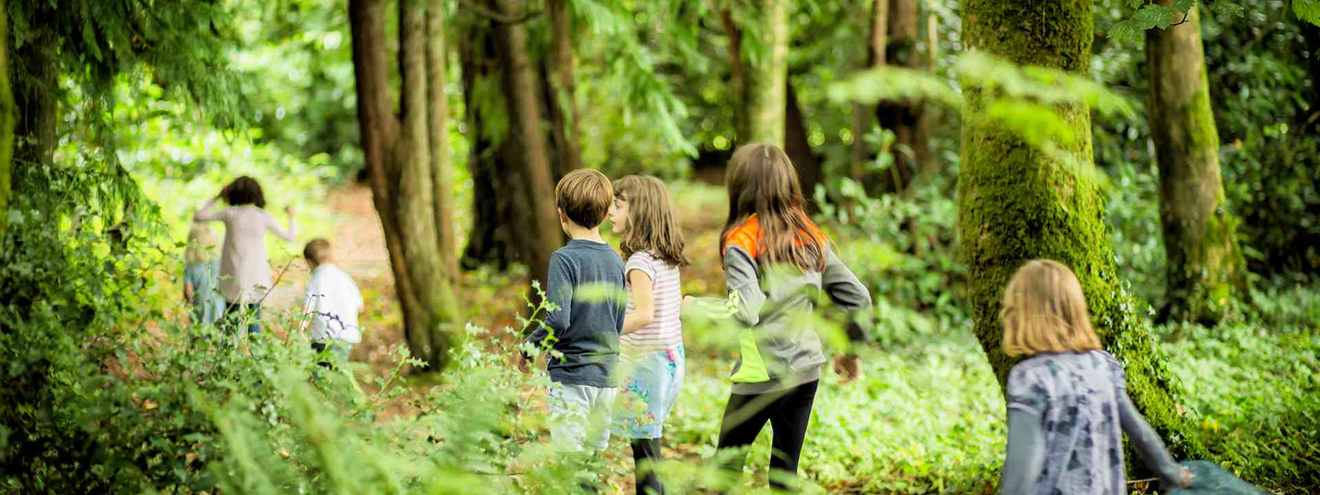
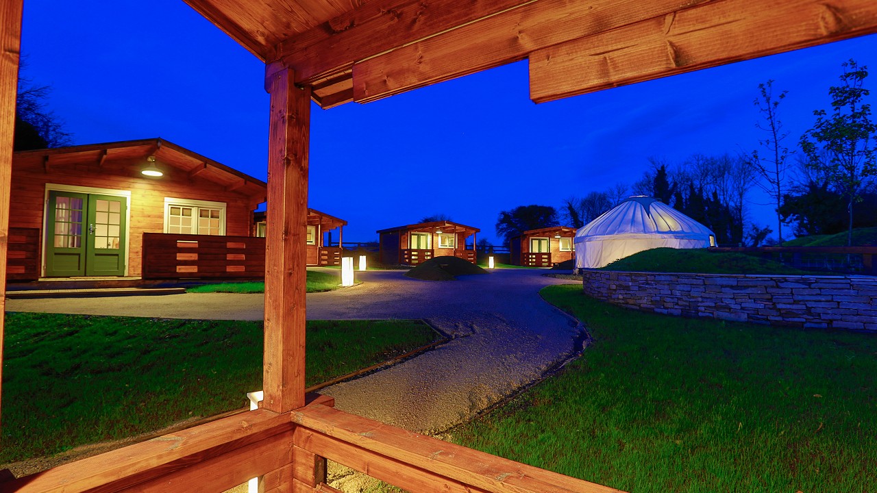
Walking in the Slieve Bloom Mountains
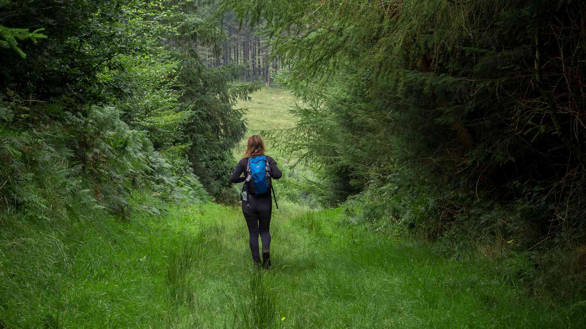
Get off the beaten track and connect with nature in the unspoilt and uncongested Slieve Bloom Mountains where you will find a great choice of walking trails ranging in distance from 4km to 70km.
Choose from 17 Slieve Bloom Looped Walks of varying length from trailheads at Kinnitty Cadamstown Clonaslee Glenbarrow and Monicknew.
Eco Walks focusing on different aspects of the flora fauna and geology of the Slieve Bloom Mountains can be found at Knockbarron, Glenafelly, Gurteenamile Silver River Cadamstown and Glenbarrow. The Circular Slieve Bloom Way can be accessed from any of the trailheads at Kinnitty, Cadamstown, Clonaslee, Glenbarrow, Monicknew. The linier way marked Offaly Way can be accessed from the trailhead at Cadamstown.
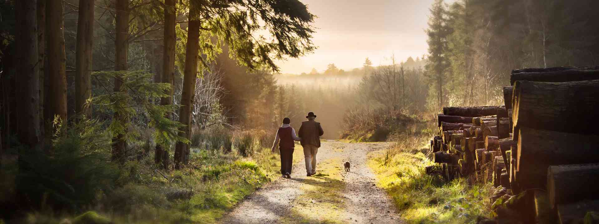
Organised walks take place on most weeks throughout the year.
Slieve Bloom Walking Festival 2025
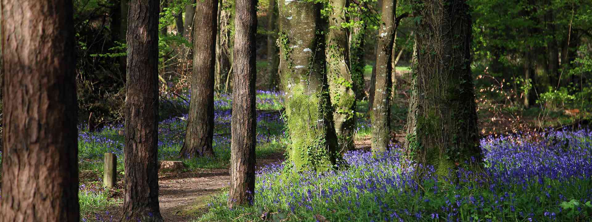
The Slieve Bloom Walking Festival takes place in spring every year as the bluebells come into full bloom and the hills are alive with birdsong.
Walking Guides
Are you looking for a personal leader who can tailor-make a walk to suit your party or group? All of our walking guides have received extensive practical walking guide training to ensure that you have a safe, educational and enjoyable experience in the Slieve Bloom Mountains. If you are looking for a personal walk leader please contact Gerry at +353 86 8210056. He will arrange walk leader for you.
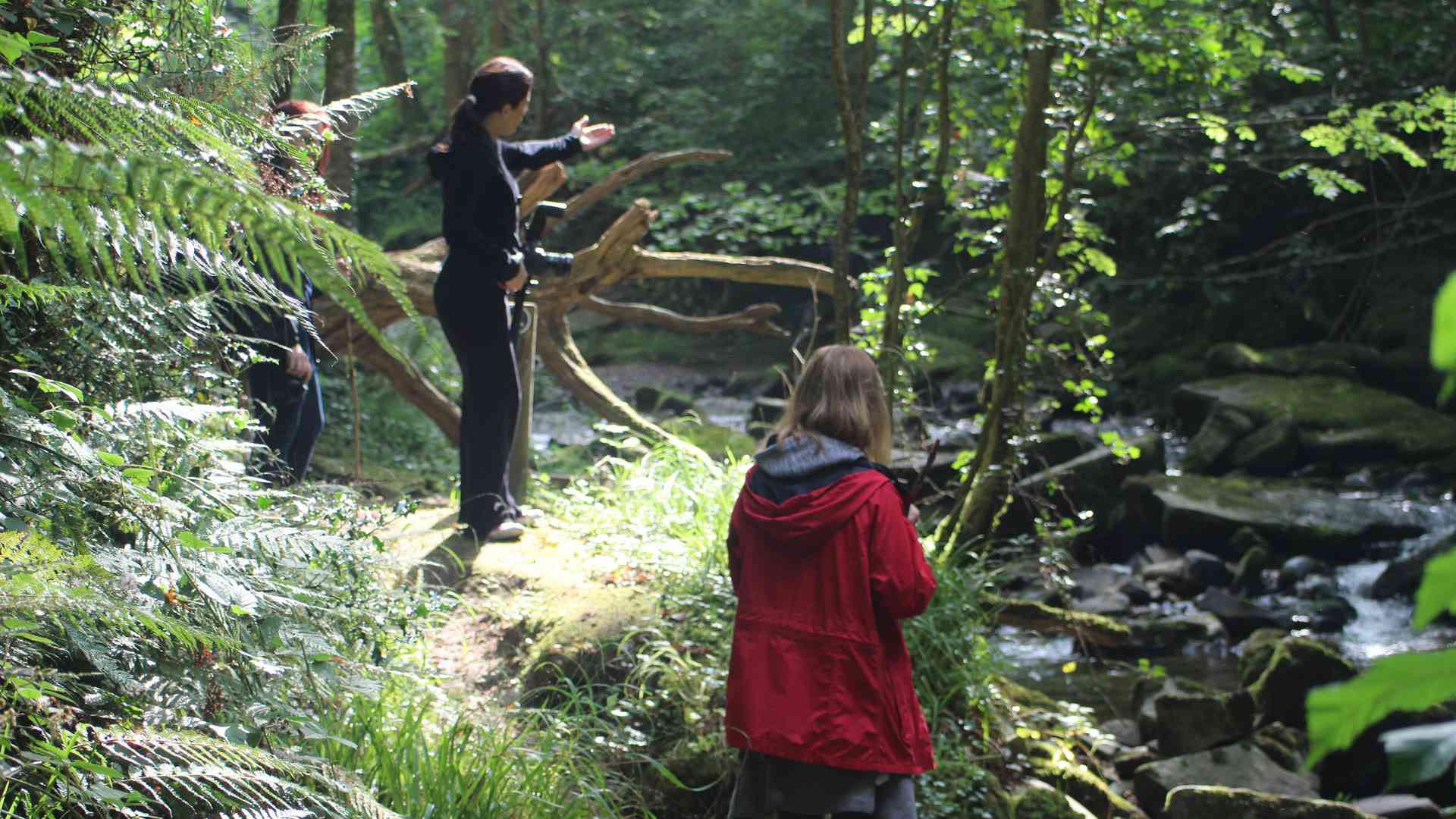
Walks Calendar
Organised walks take place on most weeks throughout the year — details of upcoming walks can be found here
Walking Trails
Walking Trails
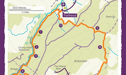
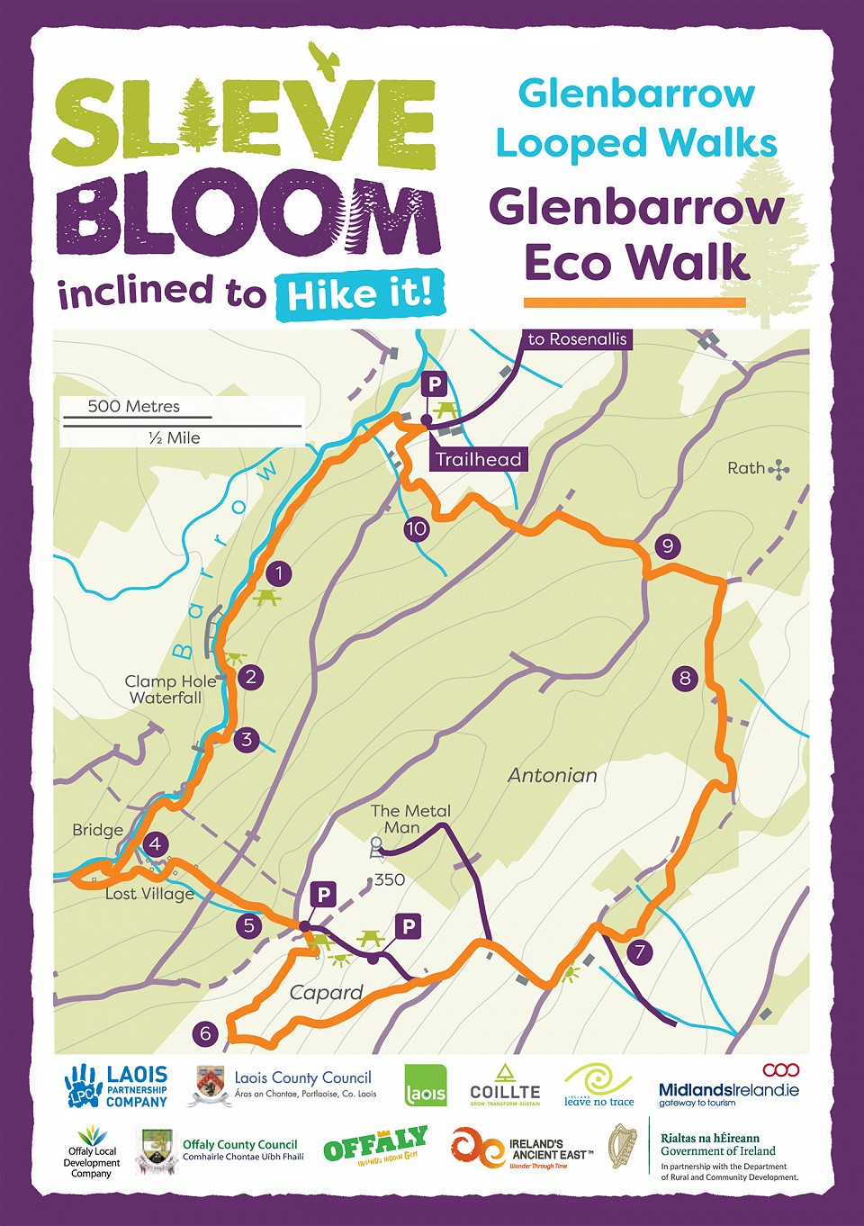
Glenbarrow Eco Walk
The trailhead is Glenbarrow carpark. Follow Orange arrows onto a downhill track. Enter Glenbarrow woods via wooden railings.
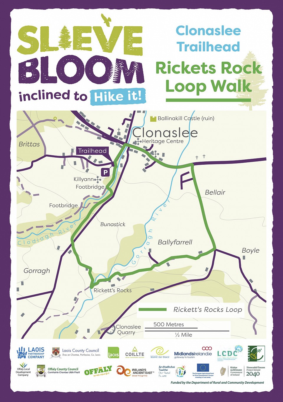
Rickets Rock Loop
Start from the entrance to the forestry in Clonaslee Village.
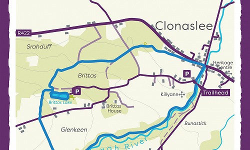
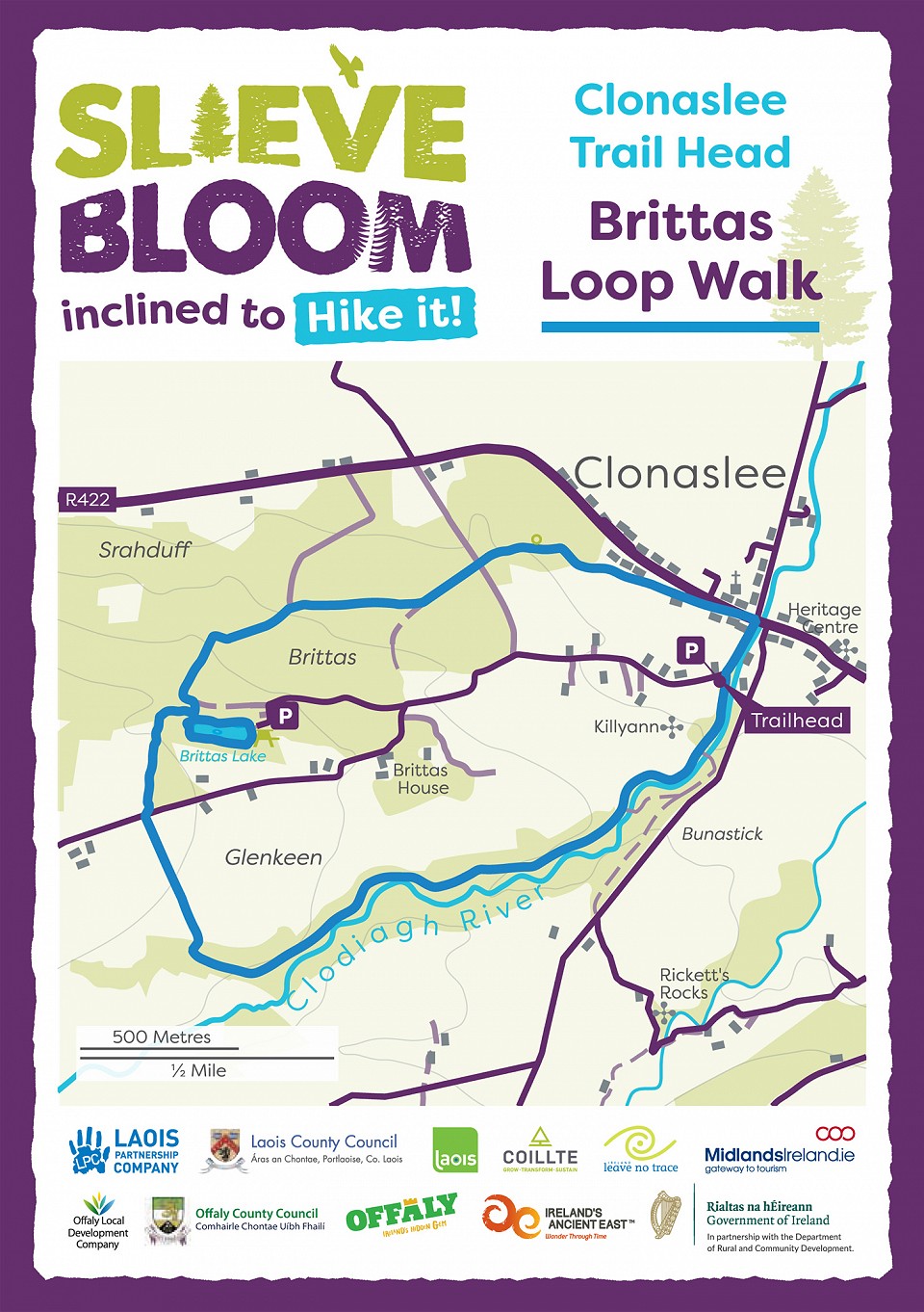
Brittas Lake Loop
This walk starts at the Coillte Trailhead site on Brittas Avenue. Follow blue arrows along by the River Clodiagh...
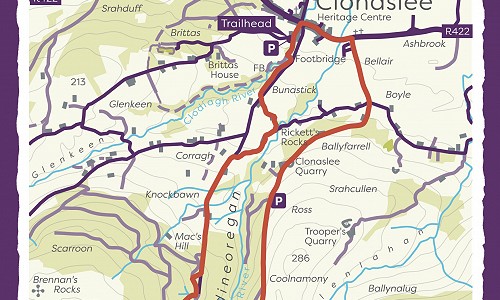
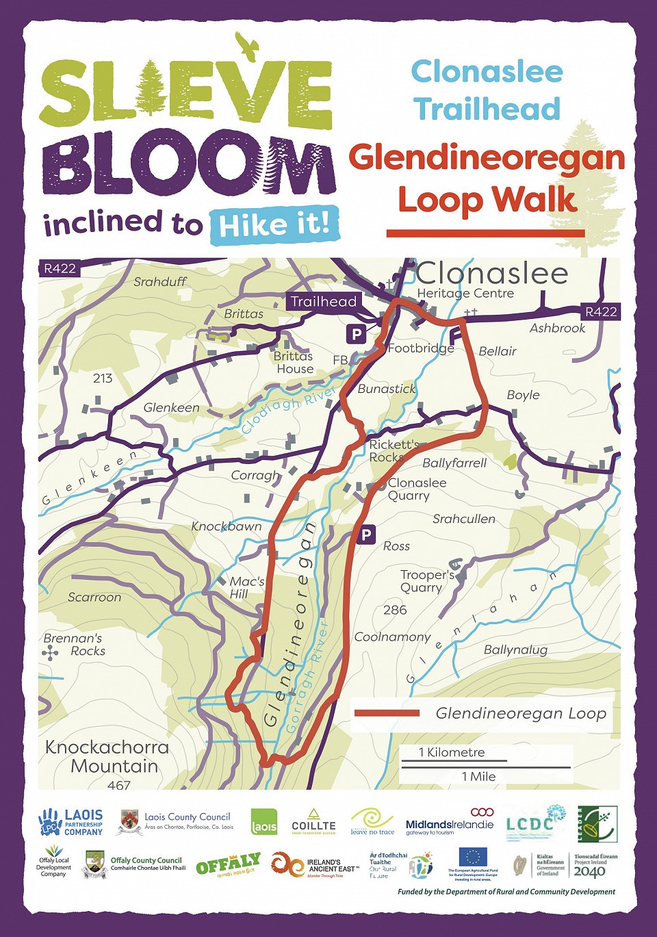
Glendineoregan Loop
tart from the entrance to the forestry in Clonaslee Village.

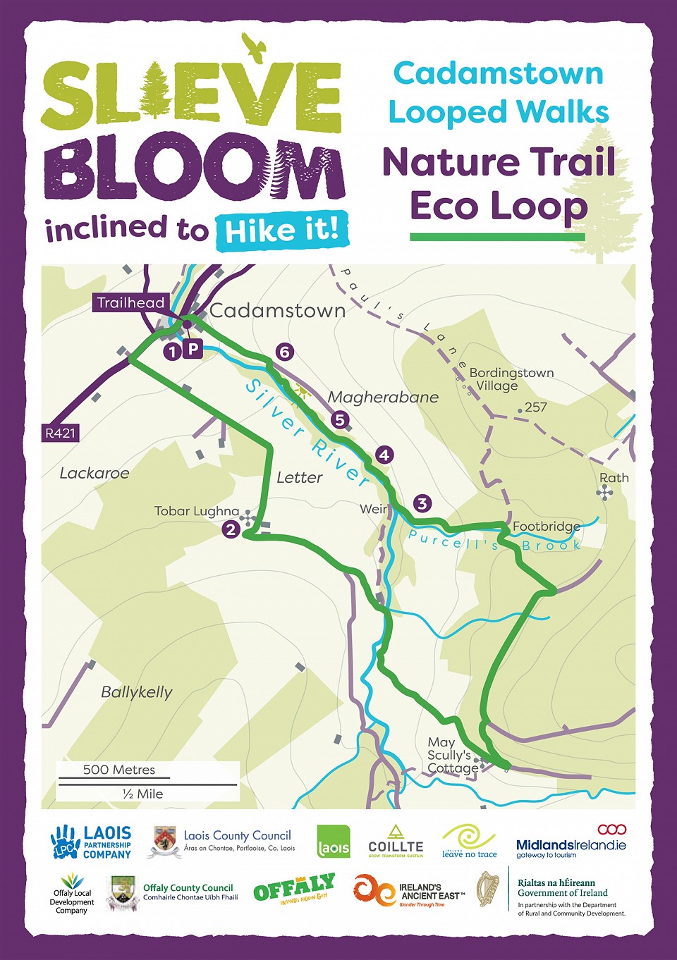
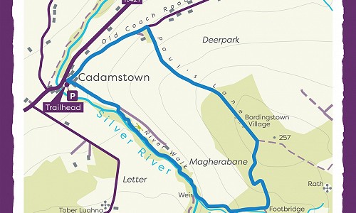
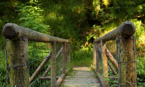
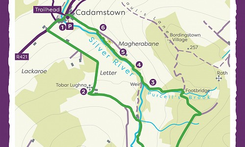
Silver River Nature Trail
At the picnic area beside the Mapboard take a look at the strangely shaped boulder.
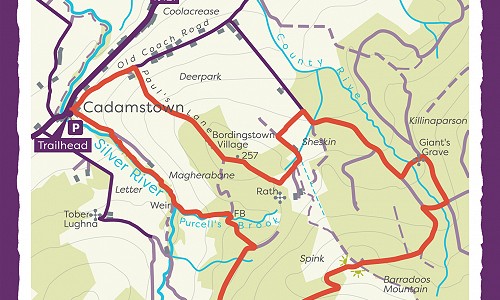
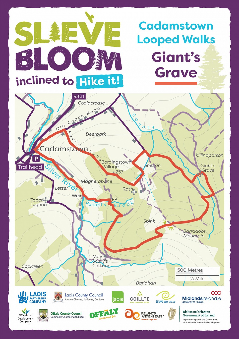
Giants Grave Loop
Starting from Cadamstown trailhead, follow the red arrows along the tarred road for 1km to reach an old laneway.
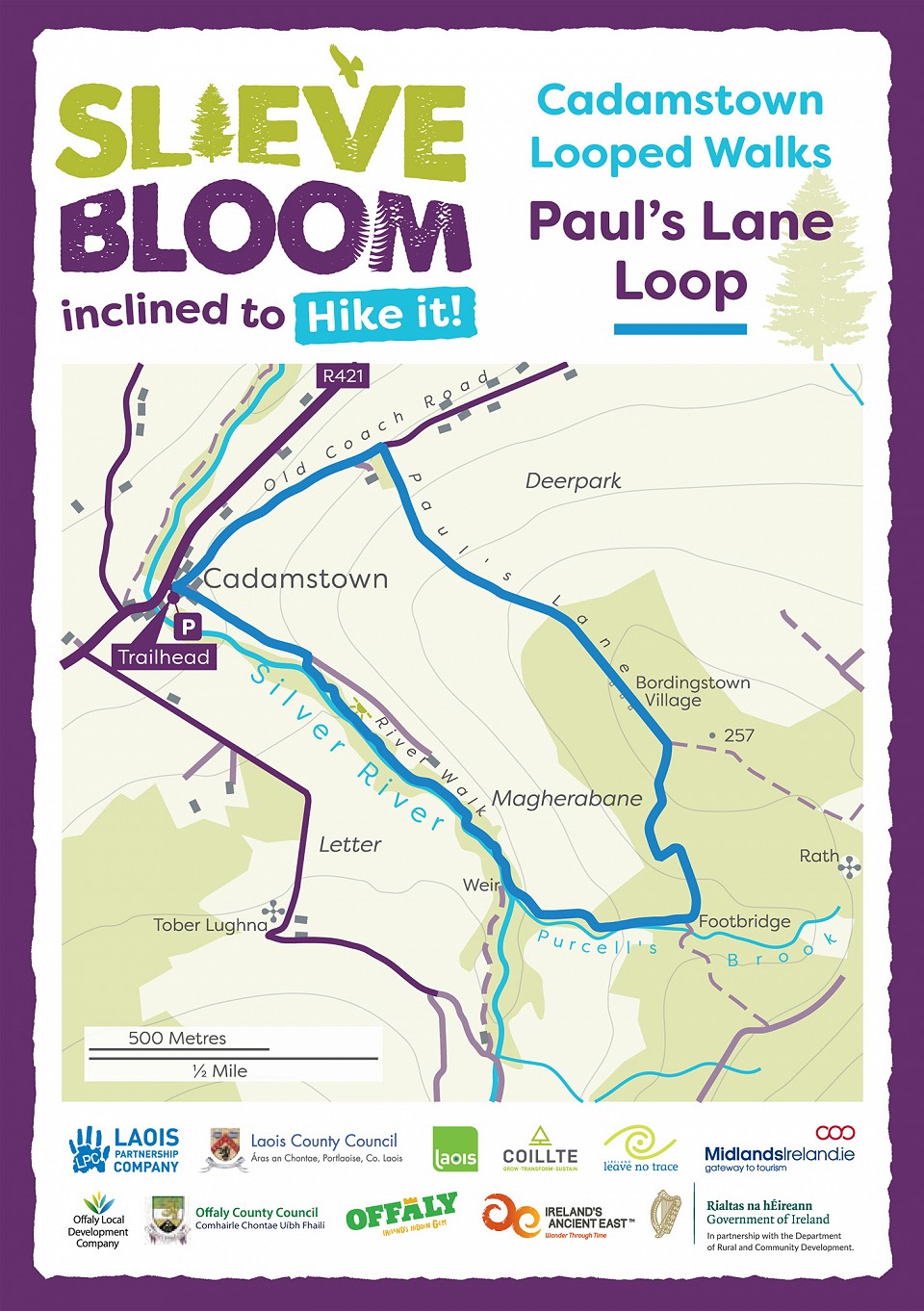
Pauls Lane Loop
Starting from the village car park in Cadamstown village, turn right onto what was the Coach Road that passes on the right of Dempsey’s pub.
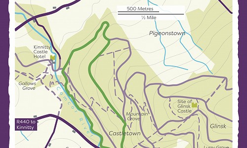
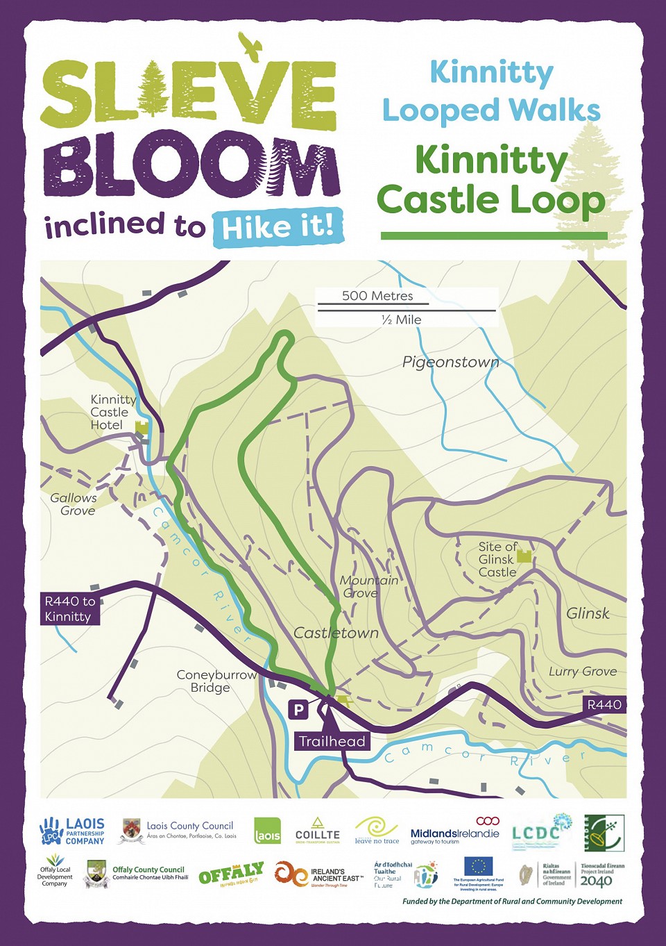
Kinnitty Castle Loop
Start from the trailhead at the forestry entrance
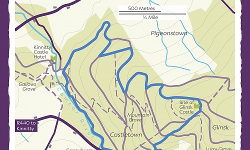
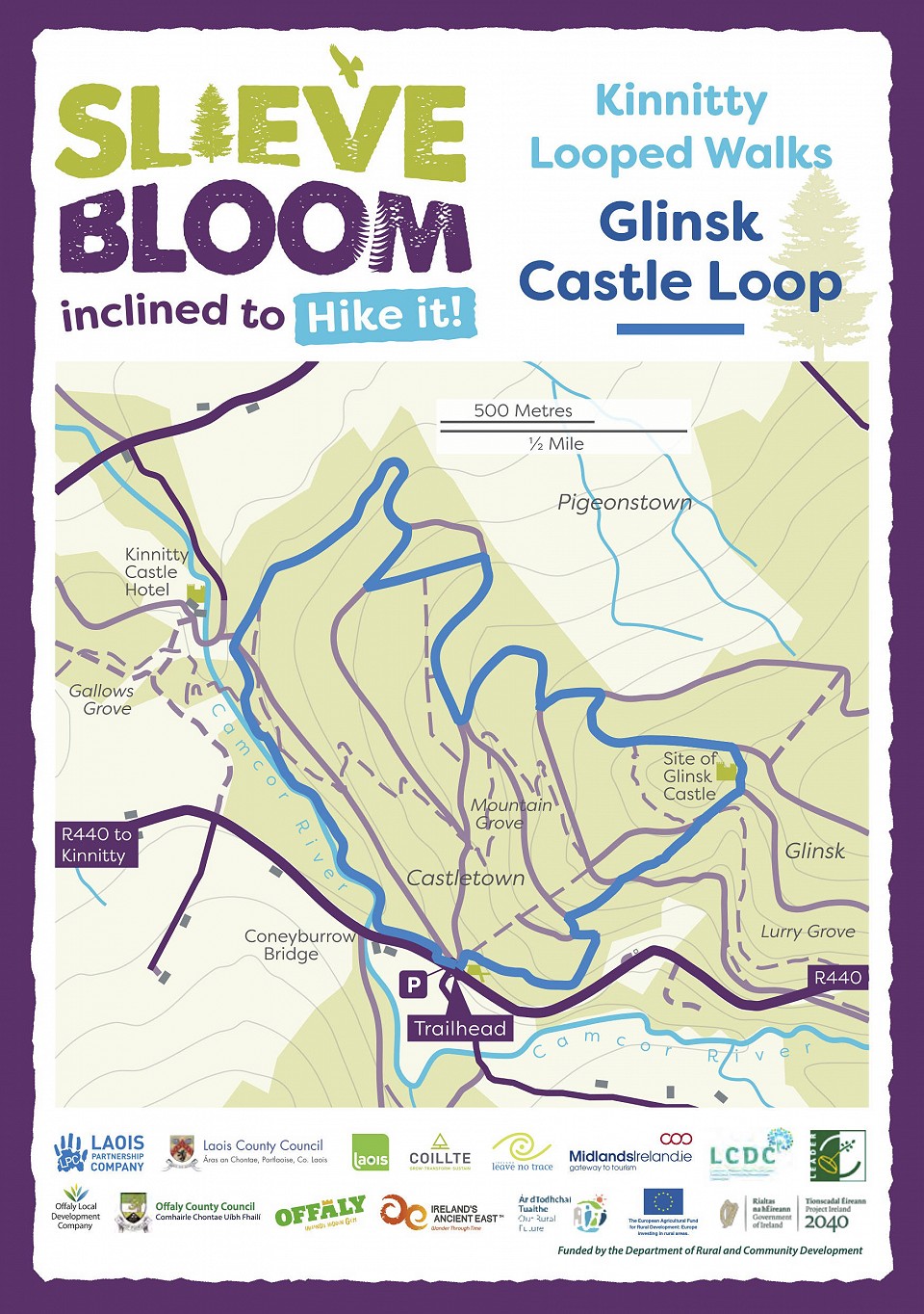
Glinsk Castle Loop
Start from Kinnitty forest entrance 3km from the village.
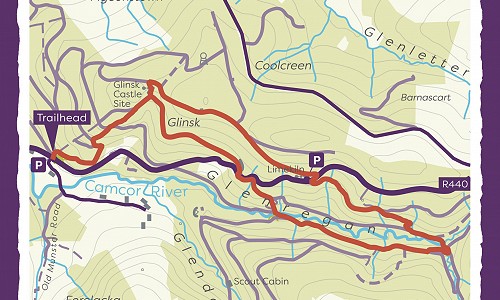
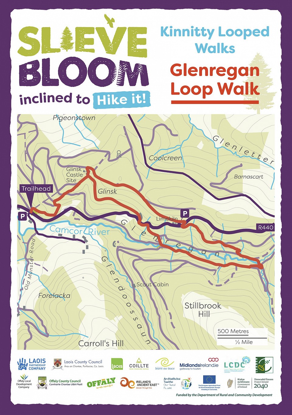
Glenregan Loop
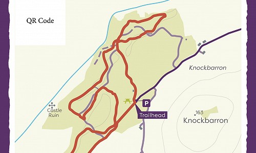
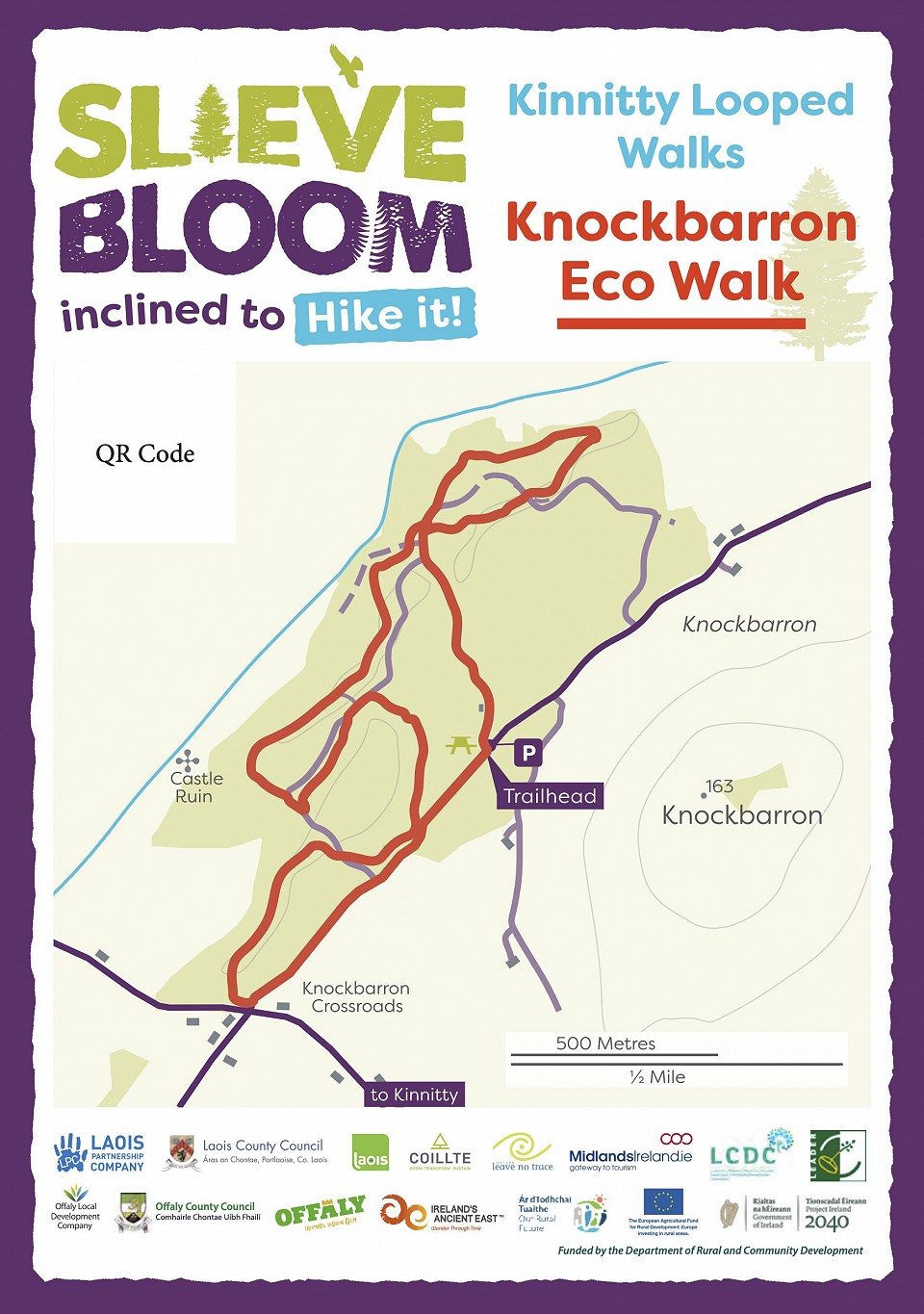
Knockbarron Wood Eco Walk
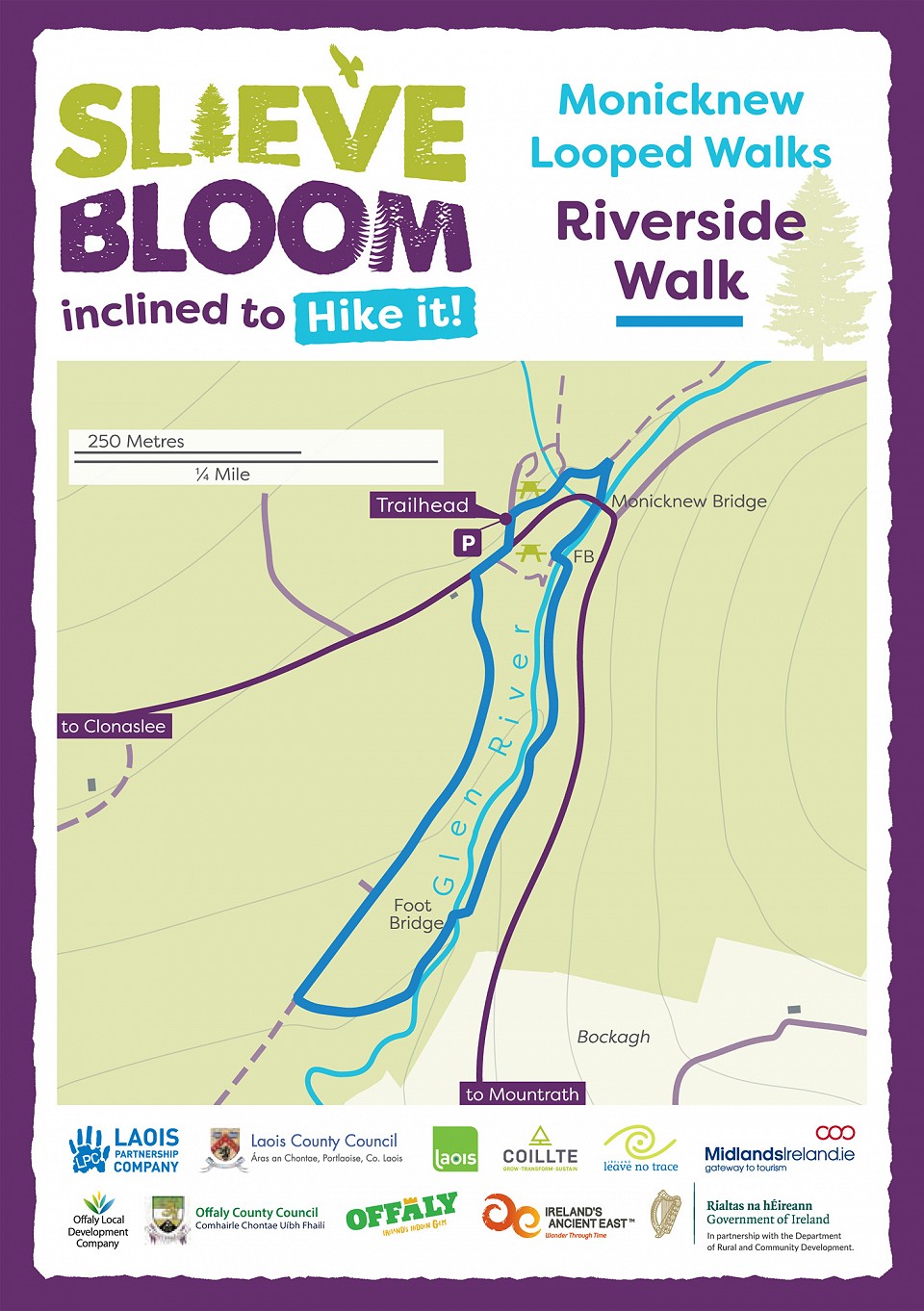
Riverside Walk
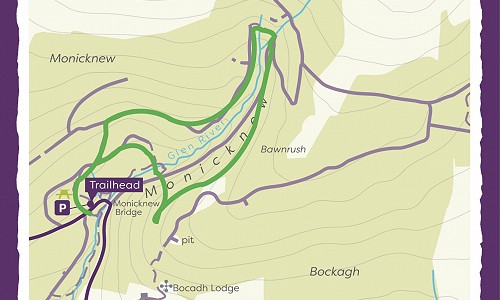
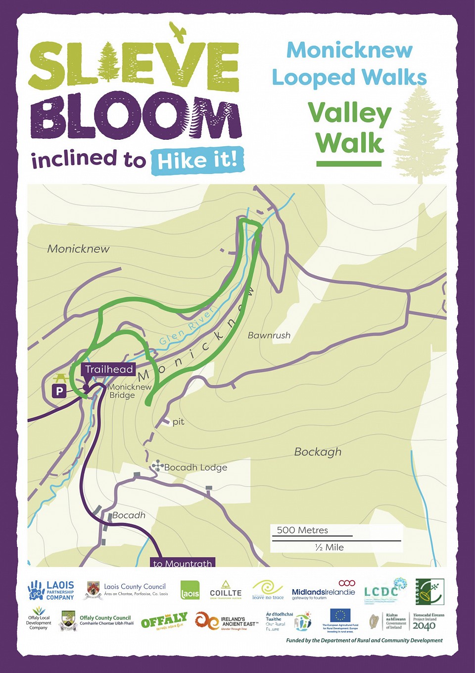
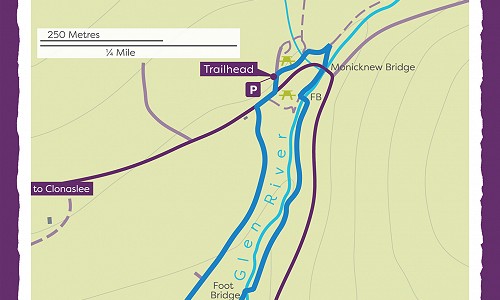
Monicknew Valley Walk
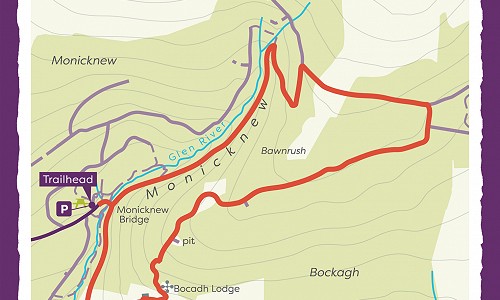
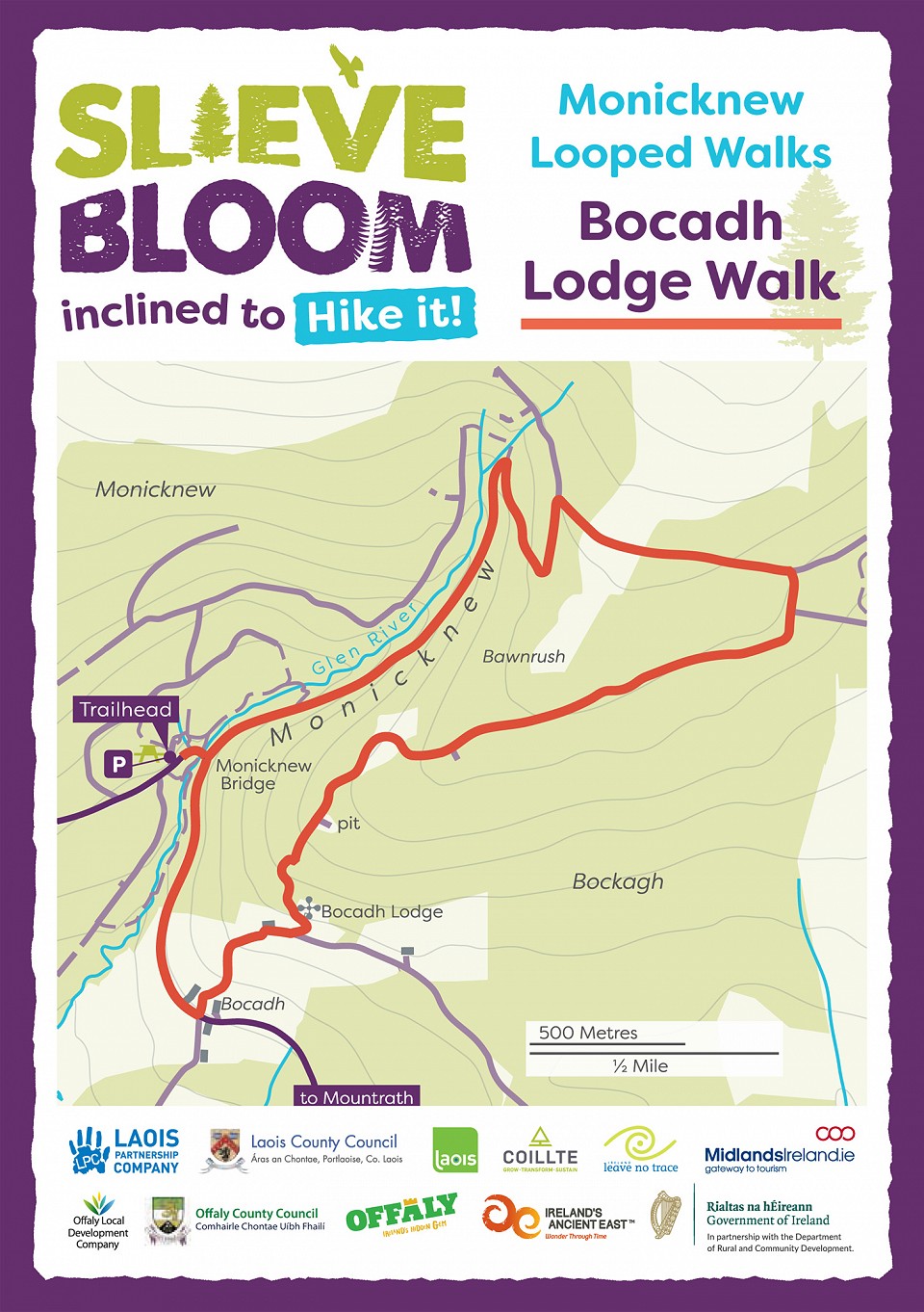
Bocadh Lodge Walk
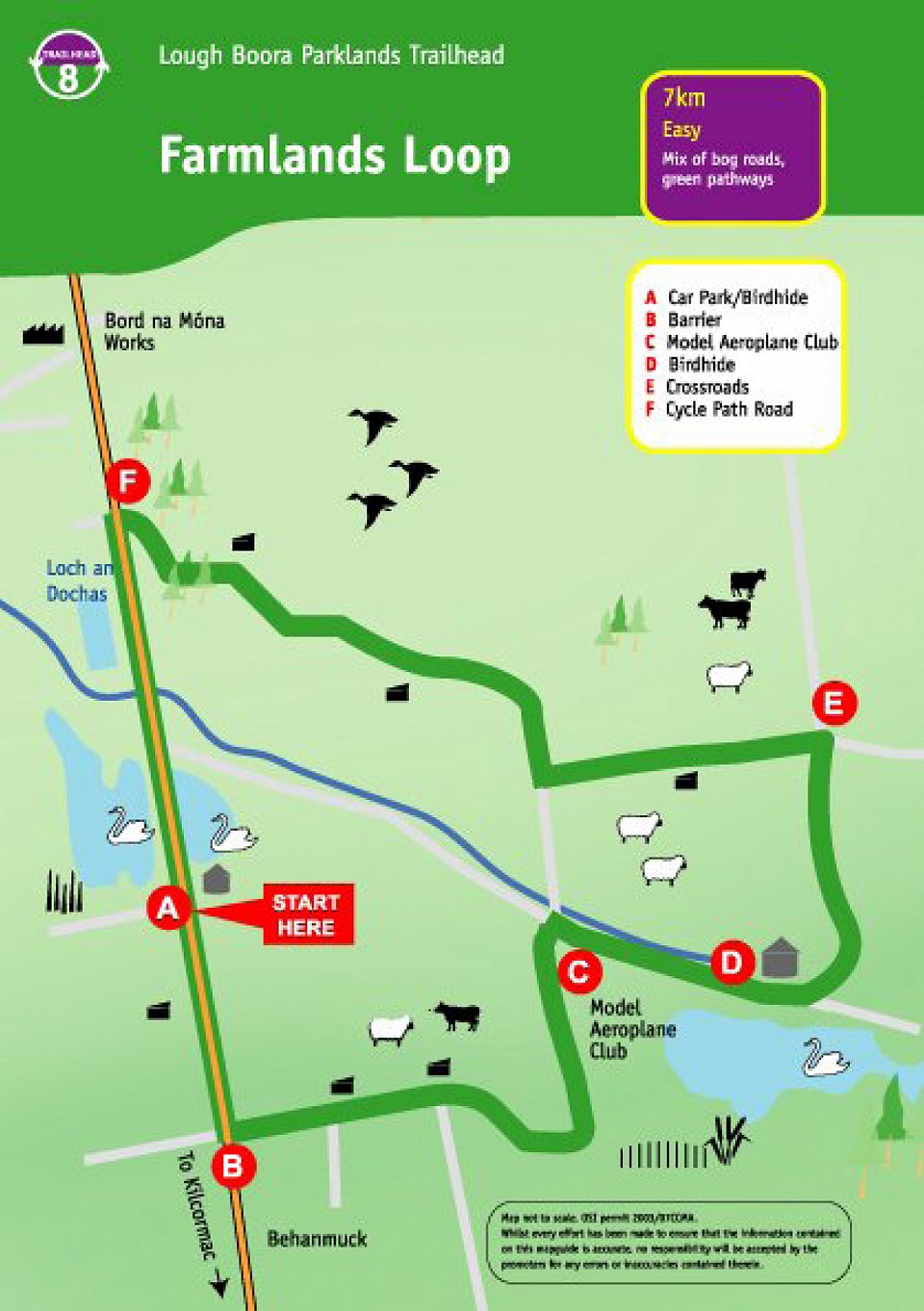
Lough Boora - Farmlands Loop
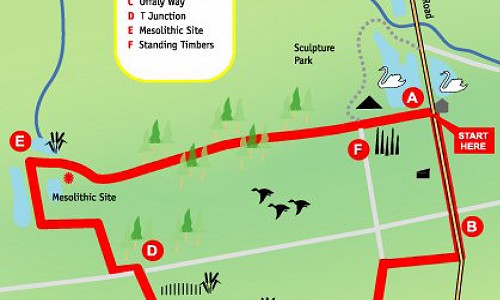
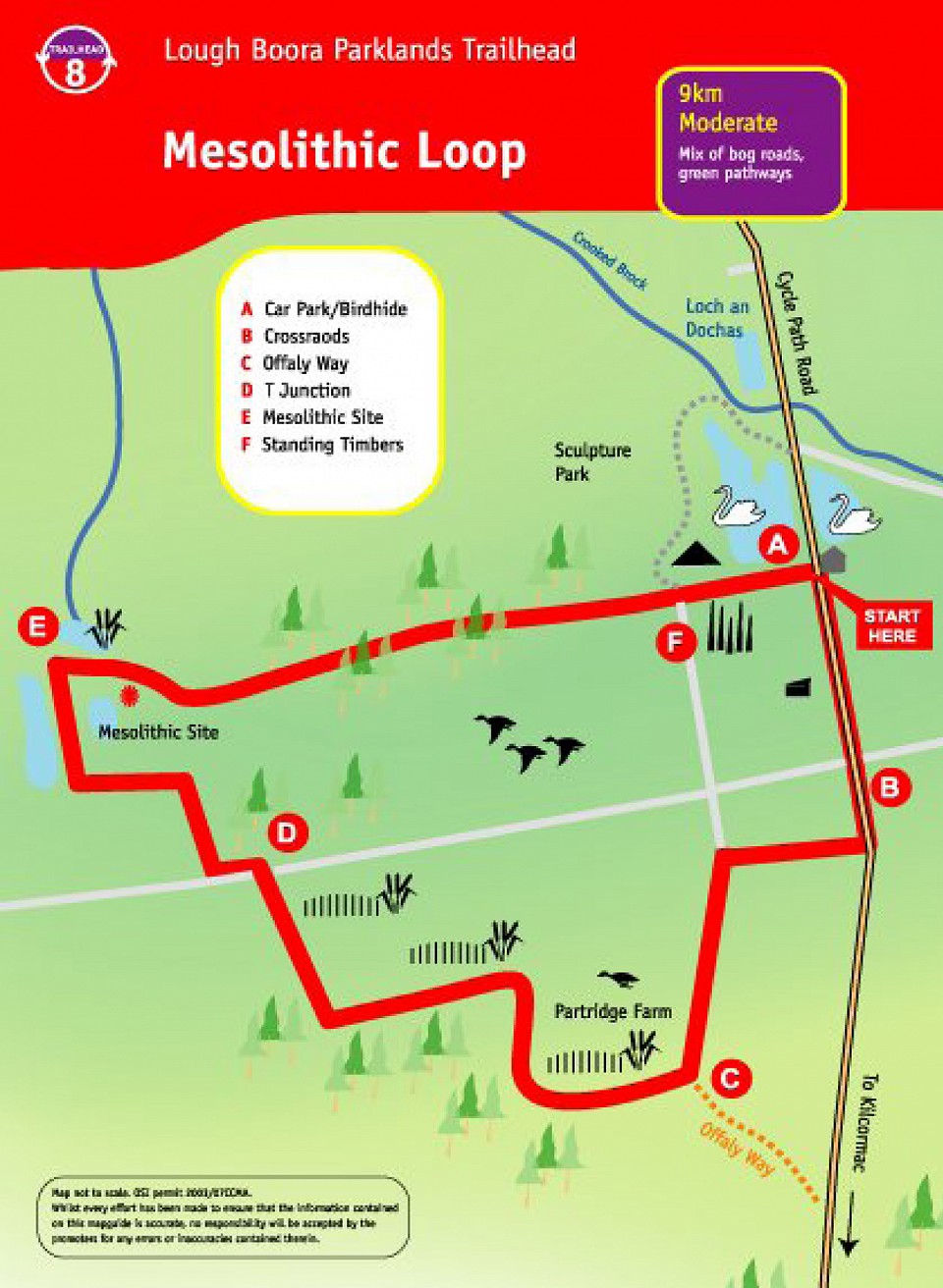
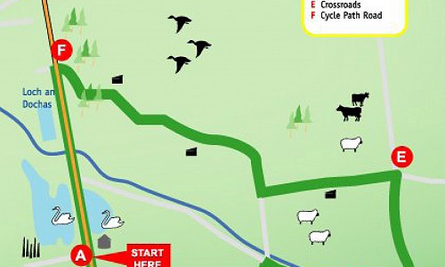
Lough Boora - Mesolithic Loop
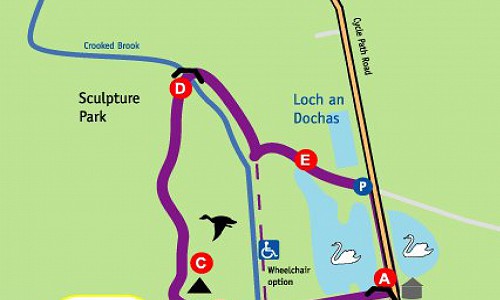
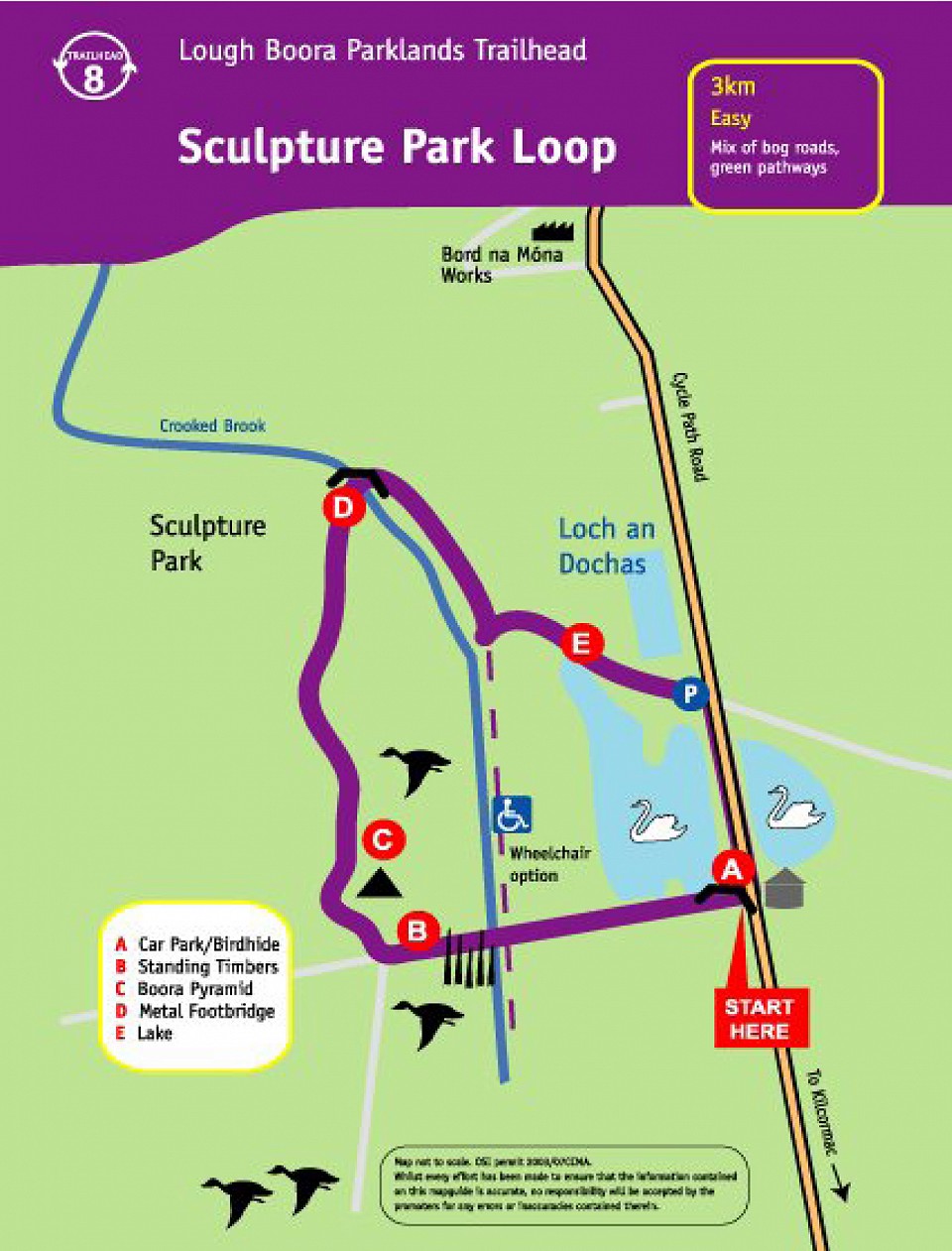
Lough Boora - Sculpture Loop
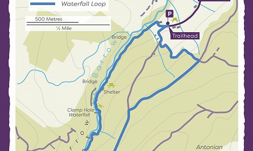
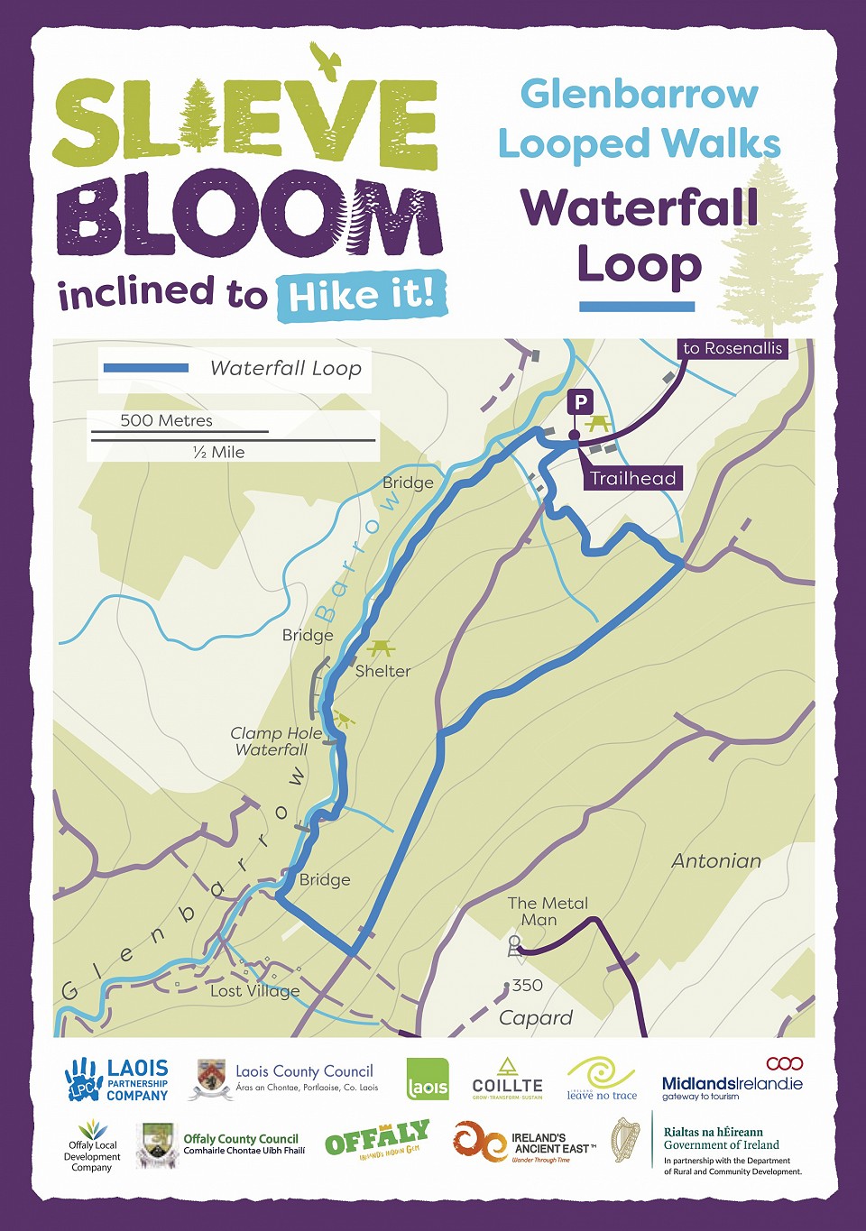
Waterfall Loop
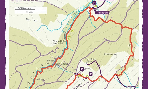
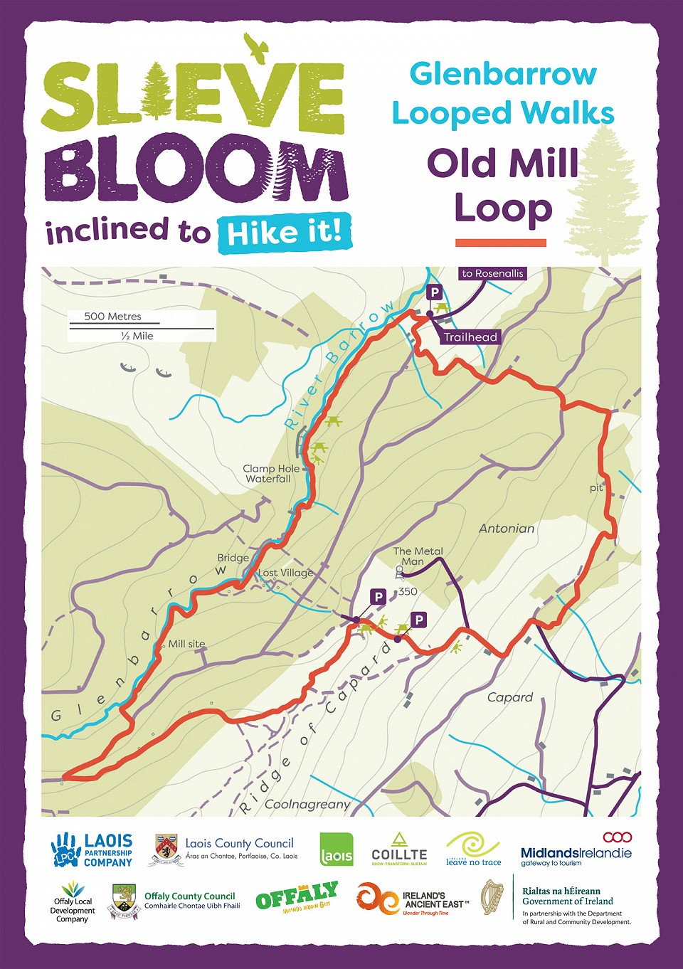
Old Mill Loop
Slieve Bloom Way
The Offaly Way
Glenbarrow
Silver River Nature Trail

Knockbarron Wood Eco Walk
Lough Boora Farmlands Loop
Lough Boora Mesolithic Loop
Lough Boora Sculpture Loop
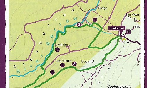
Lost Village Loop
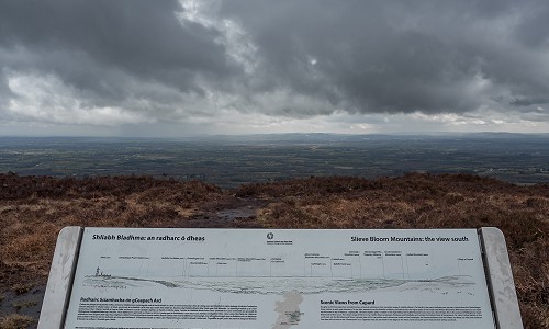
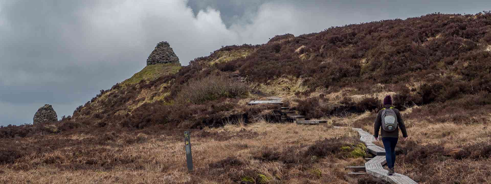
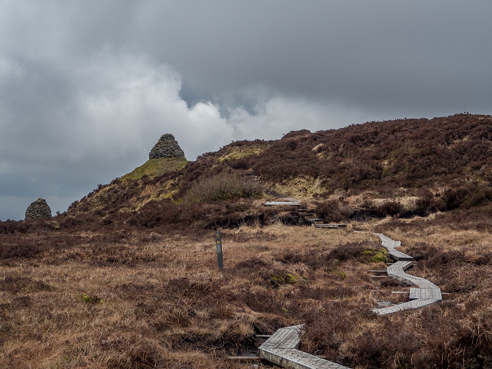
Ridge Of Capard Viewing Platform Loop
Located just 300m from the trailhead carpark, the viewing platform offers a stunning panoramic view.
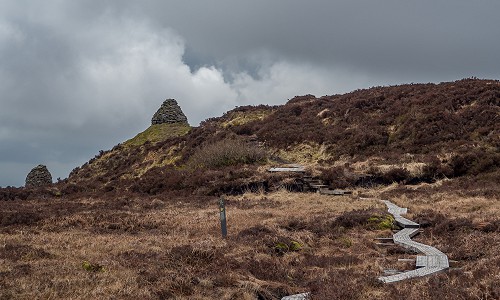
Capard Route
The Capard Route follows a specially constructed boardwalk which allows for year round access to the site without damaging the sensitive habitat.